Africa and Asia and North America Straits
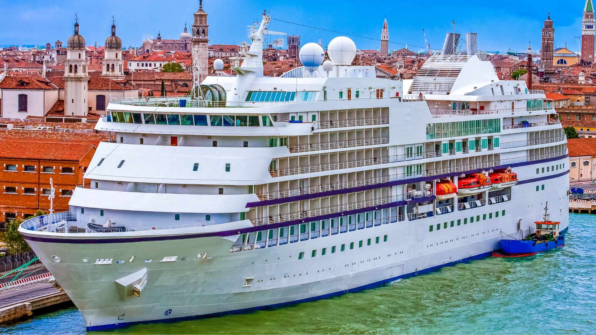
Incidentally, with regards to the English Channel, the Eurostar train goes from London’s Waterloo to Paris’ Gare du Nord station in 3 hours and 10 minutes traveling at speeds up to 160 kph/100 mph. Also, every day there are nearly 300 attempts made by illegal aliens to cross into the UK via sneaking through the tunnel. The record for swimming the English Channel currently held by Chad Hundeby of the USA with a time of 7 hours, 17 minutes back in 1994.
Here are some of the narrowest gaps in selected straits in Europe:
- Strait of Gibraltar:
- Narrowest Point: Approximately 7.7 nautical miles (14.3 kilometers) wide at Europa Point (Gibraltar) and Point Cires (Morocco).
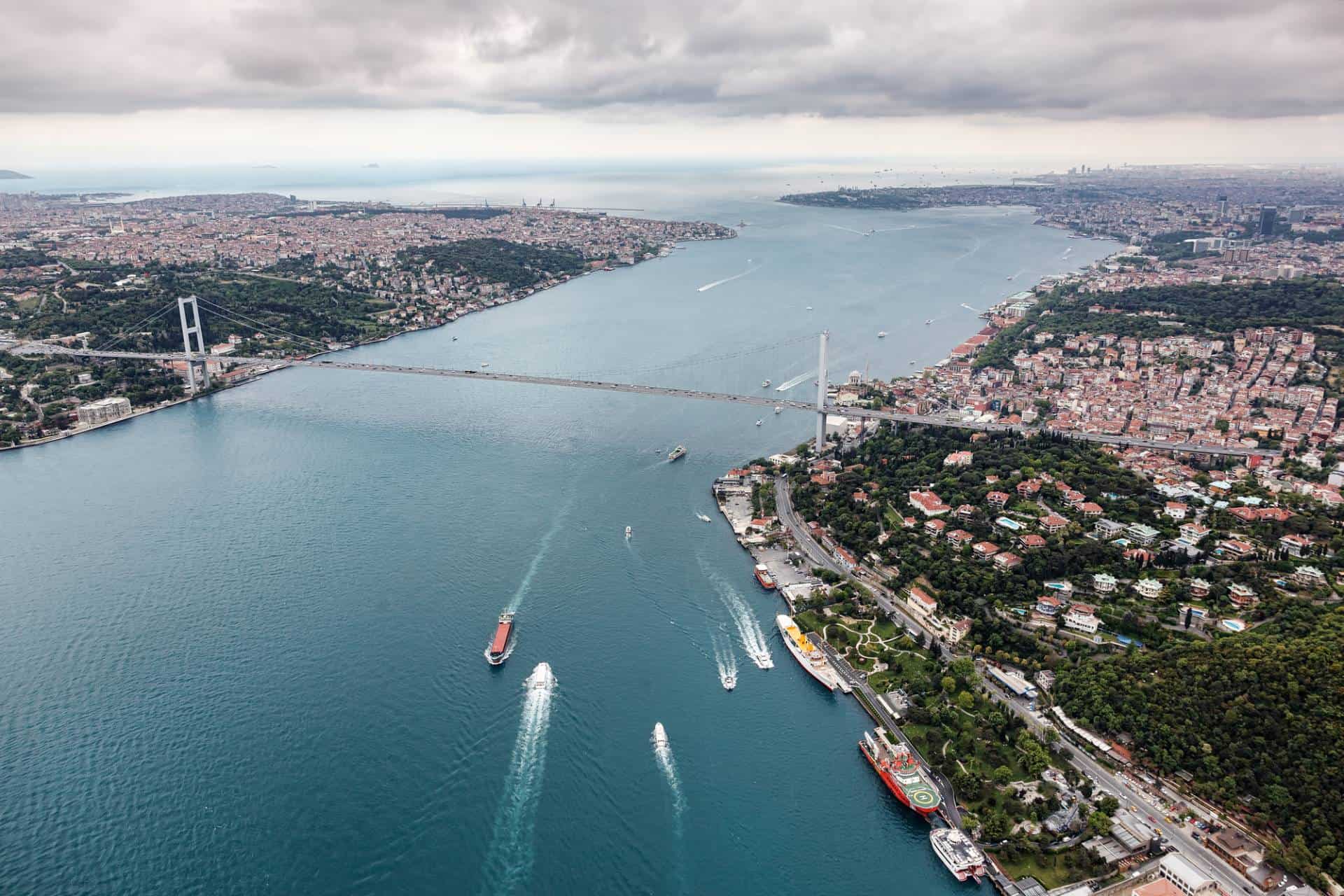
- Bosporus Strait (Istanbul, Turkey):
- Narrowest Point: Approximately 700 meters wide at its narrowest point near the Rumeli Hisarı (Fortress).
- Dardanelles Strait (Çanakkale, Turkey):
- Narrowest Point: Approximately 1,200 meters wide at its narrowest point between the Gallipoli Peninsula and the Karaburun Peninsula.
- Messina Strait (Sicily, Italy, and Calabria, Italy):
- Narrowest Point: Approximately 3.1 kilometers wide between Punta del Faro (Sicily) and Punta Pezzo (Calabria).
- Øresund Strait (Denmark and Sweden):
- Narrowest Point: Approximately 4 kilometers wide at its narrowest point between Helsingør (Denmark) and Helsingborg (Sweden).
- Kerch Strait (Russia and Crimea):
- Narrowest Point: Approximately 4.5 kilometers wide at its narrowest point between Taman Peninsula (Russia) and Crimea.
- Corinth Strait (Greece):
- Narrowest Point: The narrowest point of the Corinth Strait is spanned by the Corinth Canal, which is about 25 meters wide.
The Bering Strait, a critical maritime passage, marks the narrowest gap between Asia and North America, specifically between Russia and Alaska. This strait, named after Vitus Bering, a Danish explorer in the Russian service, is historically significant for its role as a migratory land bridge during the Ice Age, facilitating the movement of people and species between the two continents. The closest point between the two continents, through the Bering Strait, features the two Diomede Islands: Big Diomede (part of Russia) and Little Diomede (part of the U.S.), with the narrowest point of the strait measuring merely about 53 miles wide. This geographical setup not only emphasizes the physical proximity between Asia and North America but also the rich historical interactions across the Bering Sea, blending the Pacific and Arctic Oceans.
The Strait of Malacca, separating Malaysia and the Indonesian island of Sumatra, is another crucial maritime corridor linking the Pacific Ocean to the Indian Ocean. It is one of the most significant shipping lanes in the world, providing the shortest sea route between the Indian Ocean and the South China Sea, leading into the Pacific. The narrowest point of this strait is approximately 1.5 nautical miles wide, making it one of the world's narrowest straits used for international navigation. The strategic importance of the Strait of Malacca cannot be overstated, as it serves as a gateway for a significant portion of the world's maritime trade, including the passage of oil tankers bound for Asian markets from the Middle East.
The Strait of Gibraltar, the natural boundary between Europe and Africa, lies at the southern tip of Spain and the northern part of Morocco. This strait connects the Atlantic Ocean with the Mediterranean Sea and is one of the busiest shipping lanes in the world. At its narrowest point, the Strait of Gibraltar is only about 7.7 nautical miles (14.3 kilometers) wide. This critical chokepoint not only serves as a crucial passage for maritime trade but also holds historical significance as a point of military strategic importance and cultural exchange between the two continents.
The Torres Strait, which separates Australia and the archipelago region of Papua New Guinea, is another significant passage that connects the Pacific Ocean to the Arafura Sea, and thereby to the Indian Ocean. The strait is named after the Spanish explorer Luis Váez de Torres, who navigated through the area in 1606. The narrowest point of the Torres Strait is around 73 miles wide, featuring a complex maze of reefs and islands. The strait plays a vital role in the biodiversity of the region, supporting a rich marine ecosystem and the traditional way of life of the Torres Strait Islanders, who navigate these waters with a deep understanding of its complexities.
The Dardanelles, formerly known as the Hellespont, is a narrow strait in northwestern Turkey connecting the Aegean Sea to the Sea of Marmara. It forms part of the continental boundary between Europe and Asia and has been of strategic importance since ancient times. The narrowest width of the Dardanelles is about 1.2 km (0.75 miles), making it one of the most strategic points in world geography for maritime traffic, especially for nations accessing the Black Sea. The strait's historical and geopolitical significance is matched by its role in classical mythology and military history, serving as a key setting for historical events such as the Trojan War and pivotal naval battles.
These straits not only facilitate significant international maritime trade but also highlight the intricate geographical and historical connections between continents and cultures. The strategic importance of these narrow passages has influenced global trade routes, military strategies, and cultural exchanges for centuries, underscoring the interconnected nature of the world's seas and the countries that border them.
The concept of the narrowest gap separating strategic straits worldwide has long fascinated geographers and historians alike, offering a unique lens through which to examine the interconnectedness of continents, oceans, and cultures. For instance, when considering the geographical formations that link and divide mainland Asia from its neighboring islands, a region teeming with diverse ecosystems and bustling coastlines, the significance of such narrow passages becomes readily apparent. As detailed in comprehensive sources like Britannica and various academic publications (often cited with an ISBN for reference), these straits not only serve as critical maritime routes but also as natural demarcations with profound historical and ecological implications.
By 2022, advancements in digital archiving have allowed for an unprecedented consolidation of knowledge, with vast repositories of information being archived from the original sources. This accessibility jump-starts content discovery for researchers and the general public alike, enabling a deeper understanding of the world's geography. Salinity levels, a key area of study for oceanographers, provide vital clues to the water's movement and the biological diversity within these straits. The Strait of Oceania, while not a formally recognized geographic term, evokes the myriad passages that pepper the Pacific region, each with its unique challenges and stories, often studied in the context of their importance to both local and global ecosystems.
Renowned geographers and scholars frequently utilize these digital platforms to disseminate their findings, contributing to a collective knowledge pool that spans disciplines from cartography to environmental science. The examination of coastlines and their adjoining narrow straits offers insights into ancient migration patterns, trade routes, and the evolving relationship between human societies and their maritime environments. The analysis of these straits, grounded in scientific methodologies and historical context, continues to enrich our understanding of the planet's intricate geography and the forces, both natural and anthropogenic, that shape it.
In conclusion, the world's narrowest and most strategic straits, including the Bering Strait, Strait of Malacca, Strait of Gibraltar, Torres Strait, and the Dardanelles, serve as vital links in the global maritime network. These waterways underscore the geopolitical, economic, and ecological significance of maritime passages, impacting everything from international trade and military strategy to environmental conservation and cultural exchange. As the global landscape evolves, the importance of understanding and preserving these critical maritime corridors remains paramount, ensuring they continue to facilitate international cooperation and connectivity in an increasingly interconnected world.
Europe Travel Deals